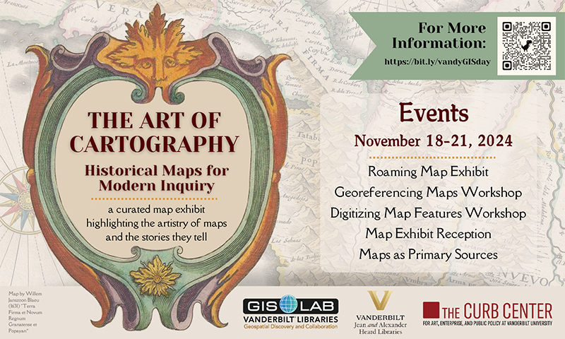
The Jean and Alexander Heard Libraries will celebrate 2024 Geography Awareness Week and GIS Day with a series of events Nov. 18–21—including hands-on workshops, exhibits and discussions of rare maps, and a campus scavenger hunt—highlighting the significance and artistry of historical maps and map making.
All in the Vanderbilt community are invited to explore how historical maps can inform our modern-day understanding of cultural heritage as well as the narratives maps convey about local communities. Participants will learn to work with historical maps as primary sources and discover how to integrate them with geospatial tools for current research and applications.
“The Art of Cartography: Historical Maps for Modern Inquiry” is presented by the Heard Libraries’ GIS Lab in collaboration with Special Collections and University Archives, with support from The Curb Center for Art, Enterprise and Public Policy at Vanderbilt.
Nov. 18–21
Roaming Map Exhibit
Various library locations
Discover a curated selection of historical maps displayed throughout the campus libraries, including depictions of Native lands in Tennessee and maps of Havana and Paris. These maps offer a window into the past and invite viewers to reflect on the intersection of geography, culture and art. Track down more than a dozen maps using our interactive app (link coming soon) and learn the stories behind each historical piece. A fun scavenger hunt experience awaits as you explore!
Monday, Nov. 18
Georeferencing Maps Workshop
2–3 p.m.
GIS Lab, Peabody Library
In this hands-on workshop, participants will learn how to georeference historical maps using ArcGIS Pro. This process involves aligning historical maps with modern spatial data, providing a new perspective on historical landscapes and their contemporary counterparts. The goals of this workshop include understanding the principles of georeferencing and its importance in historical cartography and gaining familiarity with ArcGIS Pro software and its georeferencing tools.
Tuesday, Nov. 19
Digitizing Map Features Workshop
2–3 p.m.
GIS Lab, Peabody Library
This hands-on workshop will guide participants through the process of digitizing features from historical maps using ArcGIS Pro. Participants will learn to capture and vectorize map elements, such as rivers or streets, for use in modern geographic analyses. The goals of this workshop include understanding the process and techniques for digitizing historical map features and learning best practices for ensuring accuracy and quality in digitization.
Wednesday, Nov. 20
Map Exhibit Reception
5:30–7:30 p.m.
Fireside Reading Room, Peabody Library

Join us for free snacks and drinks as we mark 2024 GIS Day and explore maps dating as far back as the 17th century. This event will delve into the art of cartography, displaying all the maps from the roaming exhibit across the campus libraries.
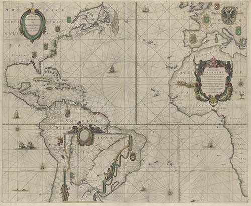
Among the highlights will be two rare maps created by renowned Dutch cartographer Willem Blaeu that were recently acquired by the Heard Libraries. The Blaeu maps, from The Collection of Stephen and Carina Bruce, were produced in Amsterdam in the 1600s during the Golden Age of Dutch cartography and exploration. West Indische Paskaert is one of the earliest printed charts of the Atlantic Ocean, showing the area chartered to the West India Company in 1621, while Pascaarte van alle de Zee-custen van Europa offers a remarkably detailed view of Europe that extends to the coast of Greenland. Both maps are currently being digitally preserved and will be made available to researchers soon.
Thursday, Nov. 21
Maps as Primary Sources
2–3 p.m.
Special Collections and University Archives, Room 108
Uncover the value of maps as primary sources. This session will explore what qualifies as a primary source, how to read and analyze historical maps, how to interpret the symbols and narratives they convey, and understanding their cultural significance. Perfect for anyone curious about the stories that maps tell and the contexts in which they were created. The goals of this workshop include developing map literacy skills to critically analyze historical maps and learning about the symbols and design choices made by cartographers during the 17th through 19th centuries.
For more information, visit the Heard Libraries GIS Lab page.